What Will You See on a Napa Valley Hot Air Balloon Ride?

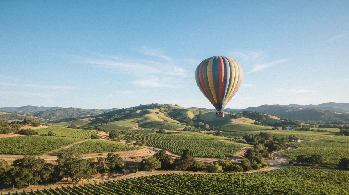
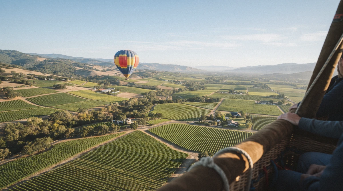
On a Napa Valley hot air balloon ride you'll almost always see the Mayacamas Mountains to the west, the Vaca Range to the east, and a patchwork of vineyard rows unrolling beneath the basket through Yountville, Oakville and Rutherford. Most sunrise flights also catch Mount St. Helena rising to the north and first light breaking over Howell Mountain, while a clear, high-wind-aloft morning can stretch the view all the way to the San Francisco skyline. What you'll see on a napa valley balloon ride changes with the wind every morning, since no pilot steers a fixed route, so this guide ranks the views by honest likelihood rather than a postcard promise. Compare the full napa hot air balloon lineup before you pick which morning to fly.
Quick answer
From the basket you'll almost always see the Mayacamas Mountains to the west, the Vaca Range to the east, and vineyard rows unrolling through Yountville, Oakville and Rutherford directly below, very often Mount St. Helena to the north and sunrise breaking over Howell Mountain, and on a good day, when the wind carries the balloon high and the air stays clear, a distant look at the San Francisco skyline.
Key takeaways
- West: the Mayacamas Mountains ridge line, on nearly every flight
- East: the Vaca Range foothills, on nearly every flight
- North: Mount St. Helena and first light over Howell Mountain, on most flights
- Lucky-day view: the San Francisco skyline and a hint of the Sierra Nevada, only on clear, high-wind-aloft mornings
- Myth to drop: there is no fixed flight path over named wineries, the wind decides the route every morning
- See the table below for exactly what shows up in each direction and how often
What You'll See, At a Glance
A quick read on the compass, before the tier-by-tier detail below it.
| Direction | What You'll See | How Often |
|---|---|---|
| West | Mayacamas Mountains ridge line | Nearly every flight |
| East | Vaca Range foothills | Nearly every flight |
| Below | Vineyard rows, the Napa River, and the rooftops of Yountville, Oakville and Rutherford | Nearly every flight |
| North | Mount St. Helena's summit | Most flights |
| Overhead light | Sunrise breaking over Howell Mountain | Most flights |
| Scattered below | Named wineries visible from aloft, including Robert Mondavi, Opus One and Sterling Vineyards | Most flights, route dependent |
| Ground level | Deer moving through vineyard rows and morning mist pooling in low spots | Regular but not every flight |
| Far south, clear mornings | The San Francisco skyline | Lucky-day sighting |
| Far east, clear high-altitude mornings | A silhouette of the Sierra Nevada | Rare |
Nothing on this list is fixed, since a hot air balloon has no rudder and no engine pushing it in a chosen direction. The wind decides the corridor every single morning, and the same route rarely repeats two days running. The three tiers below go through each of these views one at a time, then Where Each View Comes From further down flips the same picture around by location instead of direction.
On Nearly Every Flight
These four show up often enough that a sunrise flight missing every one of them would be unusual.
The Mayacamas Mountains (West)
One-line ID: a forested ridge line running the full length of the valley's western edge, often catching the first orange light of sunrise on its upper slopes. Where: visible from almost anywhere along the flight corridor between Yountville and Rutherford. When: present on nearly every flight, clearest in the cooler months when haze is thinnest.
Likelihood: nearly every flight. The memorable detail is the light itself: the Mayacamas catch sunrise minutes before the valley floor does, so pilots often time the ascent to put that ridge glow directly ahead of the basket. Best hour: right at first light, before haze builds later in the flight.
The Vaca Range (East)
One-line ID: a drier, lower range than the Mayacamas, its slopes a duller gold-brown for most of the year. Where: the eastern horizon on every stretch of the corridor. When: present on nearly every flight.
Likelihood: nearly every flight. The Vaca Range holds far less vineyard planting than the valley floor or the Mayacamas foothills, so its slopes read as open rangeland from the air, a genuine contrast that first-time flyers often ask about mid-flight. Best hour: no strong pattern, visible steadily through the flight.
Vineyard Rows and the Napa River (Below)
One-line ID: tight, ruler-straight rows running in every direction, threaded by the slow curl of the Napa River. Where: directly beneath the basket for the entire flight, regardless of which stretch of the corridor the wind carries you over. When: present on nearly every flight.
Likelihood: nearly every flight. From altitude the row spacing and trellis pattern actually identify which grape variety is planted below, something most pilots can call out by sight if you ask. The flagship Yountville flight launches directly into this patchwork, so it's the first thing most passengers see once the basket clears the trees.
Best hour: no strong pattern, visible for the whole flight.
Yountville, Oakville and Rutherford (Small Towns)
One-line ID: compact clusters of rooftops and church spires breaking up the vineyard grid, each town small enough to take in with a single glance from altitude. Where: strung along the valley floor in that order heading north from the launch field. When: present on nearly every flight, since the standard corridor tracks this same stretch.
Likelihood: nearly every flight. Rutherford in particular sits at a natural bend in the river, which pilots use as a landmark for judging drift speed mid-flight. Best hour: no strong pattern, visible for the whole flight.
Most Flights
One step down from certain, these show up on most mornings without being a sure thing.
Mount St. Helena (North)
One-line ID: the valley's tallest peak, a dark, forested cone anchoring the northern skyline. Where: visible looking north from anywhere along the corridor, sharper on flights that launch or drift toward the upper valley. When: present most flights, clearest on cool, dry mornings.
Likelihood: most flights. On the rare morning when Yountville fogs in, the backup launch at Pope Valley actually sits closer to this peak, which pilots sometimes mention as the one upside of a relocated launch. Best hour: right after sunrise, before any haze builds toward the north.
Sunrise Over Howell Mountain
One-line ID: the first direct sunlight of the day breaking over a lower ridge east of St. Helena, catching the basket and the passengers before it reaches the valley floor. Where: to the northeast, visible in the minutes right after liftoff.
When: present most flights, tied to the exact minute of sunrise rather than a location. Likelihood: most flights, occasionally missed on flights that launch a few minutes behind schedule or into thicker morning haze. The moment itself is why every operator insists on a sunrise departure rather than any other hour, since the light crossing the basket at that angle doesn't repeat later in the morning.
Best hour: the first five to ten minutes after liftoff.
Named Wineries From Aloft
One-line ID: recognizable estate buildings and planted blocks, visible as landmarks rather than as anything you'd tour from the air. Where: Robert Mondavi's arched winery sits near Oakville, Opus One a short distance south of it, and Sterling Vineyards' hilltop tram station stands out above St. Helena.
When: present most flights, depending on the exact corridor the wind draws that morning. Likelihood: most flights, route dependent. These are mentioned strictly as visual landmarks pilots point out, not as stops the flight makes or an endorsement of one estate over another.
Best hour: no strong pattern, whenever the corridor happens to pass near one of them.
Deer and Morning Mist in the Vineyards
One-line ID: small groups of deer moving low through the vine rows, and thin mist pooling in the valley's lowest pockets before the sun burns it off. Where: scattered through the vineyard floor, most visible right after liftoff while the air is still cool. When: present most flights, especially in the cooler months when mist forms more readily.
Likelihood: regular but not every flight. Deer tend to freeze rather than bolt when a shadow passes silently overhead, since a balloon makes almost no sound they associate with danger, which is why sightings from the basket are often closer and calmer than from the ground. Best hour: the first fifteen minutes after liftoff, before the mist clears.
On a Lucky Day
This is the part of the flight where a genuinely rare view is possible, and the honesty is the point rather than a disclaimer.
The San Francisco Skyline
One-line ID: a faint cluster of towers on the far southern horizon, visible only when the air is unusually clear and the balloon climbs high enough to see past the valley's own hills. Where: to the south, well beyond Napa town itself. When: present on a small share of flights, tied entirely to that morning's visibility and altitude rather than any season.
Likelihood: lucky-day sighting. Passengers who catch this view almost always describe it the same way, a silhouette rather than a postcard shot, since real distance and haze soften it considerably even on a good day. Best hour: no reliable window, it comes down to that specific morning's air quality more than timing.
The Sierra Nevada Silhouette
One-line ID: a faint line of distant peaks on the far eastern horizon, only visible on the clearest, highest-altitude mornings of the year. Where: far to the east, well past the Vaca Range. When: present on a very small share of flights.
Likelihood: rare. This is the single rarest view on the whole flight, rarer even than the San Francisco skyline, since it needs both altitude and exceptional clarity to line up at once. Best hour: no reliable window, entirely a function of that morning's conditions.
Where Each View Comes From
The tiers above organized everything by direction and distance. This section flips the same picture around by place along the corridor, since where the wind actually carries the balloon changes what you personally see as much as the direction does.
- Yountville launch field: the first few minutes after liftoff, when the Mayacamas catch early light and the town's own rooftops are still directly below. The flagship shared flight begins here every morning it flies.
- Oakville and Rutherford: the middle stretch of most corridors, where Robert Mondavi and Opus One come into view as landmarks and the Napa River's bend near Rutherford becomes a useful reference point.
- The Mayacamas foothills: on mornings when the wind carries the balloon closer to the western ridge, this stretch delivers the clearest close-up view of the mountains themselves rather than just their outline.
- Toward Napa town: on flights that drift south rather than north, the town of Napa and, on a lucky morning, the San Francisco skyline beyond it come into view instead of the upper-valley towns.
- The Sonoma side of the corridor: the cross-county flight from Sonoma crosses the Carneros Valley AVA before reaching Napa airspace, a genuinely different early stretch of view than any Yountville-launched flight sees.
| Look this way | What comes into view |
|---|---|
| West | The Mayacamas Mountains rising along the valley edge |
| East | The sculpted ridges of the Vaca Range catching first light |
| North | Mount Saint Helena marking the head of the valley, with sunrise spilling over Howell Mountain |
| Straight down | Patchwork vineyard rows, the Napa River, and the small towns of Yountville, Oakville, and Rutherford |
| Far south on a clear morning | The San Francisco skyline, and sometimes the distant edge of the Sierra Nevada to the east |
The Flight Corridor and What You'll See From It
Every flight drifts with that morning's wind rather than a fixed route, but the pins below mark the towns, ridge line and peaks that make up the corridor most sunrise flights pass through or near.
When You'll See the Clearest Views
Most of what's on this page holds true in any month, since the mountains, the river and the vineyard patchwork don't go anywhere. What actually shifts by season is visibility itself: the clearer, drier mornings of spring and fall give the far-off views, the San Francisco skyline especially, their best real chance, while summer's morning fog and winter's rain both cut visibility down before they cut anything else. Harvest season, September and October, adds a genuine bonus that has nothing to do with distance: the vineyard rows themselves turn gold and copper beneath the basket, a view unique to those few weeks.
For the full month-by-month breakdown of fog risk, temperatures and crowd levels, see our best time for a hot air balloon ride in Napa Valley guide.
What You Won't Always See
Two expectations catch first-time flyers off guard, and both trace back to the same misunderstanding, that a hot air balloon flies a route the way an airplane or a bus does.
The first is a promised view of one specific named winery. Robert Mondavi, Opus One and Sterling Vineyards are all real landmarks visible from the air on many mornings, but a balloon has no engine and no rudder, so the pilot cannot steer toward any one property on request. The wind decides the corridor fresh every morning, and the same route rarely repeats two days running.
The second is the San Francisco skyline itself. It photographs beautifully in operators' own marketing, and on a clear, high-wind-aloft morning it genuinely is visible, but it is a lucky-day sighting, not a standard feature of the flight, and plenty of genuinely excellent mornings never bring it into view at all.
How to See the Most From the Basket
We've found a handful of habits genuinely change what a flight shows you, more than luck does.
- Ask your pilot which direction the corridor is running that morning. Pilots read the wind before liftoff and usually know within the first few minutes whether the flight is trending toward Napa town or up toward the Mayacamas.
- Get to the launch field on time. The earliest minutes after liftoff carry the clearest light and the calmest air, and a late check-in can mean missing the sunrise-over-Howell-Mountain window entirely.
- Look down as much as out. First-time flyers fixate on the horizon and often miss the deer, the mist, and the river bend directly below, some of the most reliably good views of the whole flight.
- Bring a real camera rather than relying on a phone. The San Francisco skyline and Sierra Nevada, on the mornings they do appear, sit at genuine distance and reward actual zoom.
- Ask before the flight whether that morning's forecast favors a clear-air chance at the skyline. Pilots generally have a good read on visibility well before liftoff, even if they can't promise the wind's direction.
Frequently Asked Questions
Will I definitely see the San Francisco skyline on my flight?
No, and any page that promises it is overselling the flight. It's a lucky-day sighting that depends on a clear morning and enough altitude to see past the valley's own hills, not a standard feature of the ride.
What mountains can I see from a Napa Valley hot air balloon ride?
The Mayacamas Mountains to the west and the Vaca Range to the east on nearly every flight, plus Mount St. Helena to the north on most flights.
Can I see specific wineries like Opus One or Robert Mondavi from the balloon?
Often, yes, as landmarks along the corridor, but the pilot cannot steer toward any specific property since a balloon has no engine or rudder. Which wineries come into view depends entirely on that morning's wind.
Do balloon pilots fly the same route every morning?
No. The wind decides the corridor fresh each day, so even flights launching from the same field rarely trace the same path twice in a row.
Will I see any wildlife from the balloon?
Deer moving through the vineyard rows are a regular but not every-flight sighting, most visible in the first fifteen minutes after liftoff while morning mist still sits low in the vines.
Does the flight path change if I book the Sonoma-to-Napa flight instead of the Yountville flight?
Yes. That flight launches from a private airfield in Sonoma and crosses the Carneros Valley AVA before reaching Napa airspace, an early stretch of view that Yountville-launched flights never see at all.
Every flight over this valley is really two views stacked on top of each other: the wide, dependable geography that shows up almost every single morning, and the handful of far-off, weather-made sights that only a lucky sunrise delivers. Either one, honestly, is worth setting an alarm before dawn for.